Well, we certainly saved the best until last this year. A year ago, Ruth suggested we hike Mt. Cheam, but several reports indicated that many parts of the trail at the end of August that year were still buried under snow. We didn't feel up to dealing with huge snowfields, so we agreed that we would put Cheam on our list of "must do's" and tackle it if the trails were clear in August 2012.
 |
| The "Good" Part of the Road |
Although it would be challenging, we both felt we could handle the hike; however, we were keenly aware that we would first have to conquer the decommissioned logging road that led to the trailhead. While the Subaru's manual cautioned the owner that it was "first and foremost a passenger car," we had heard of others who had made it to the top in a Forester like mine. I spent the night before the hike watching
YouTube videos of off-road adventures, psyching myself up for the drive the next day. Don loaded a shovel and some solid boards that came from an old bed frame into my car, then gave some last minute advice, and I was on my way.
The air was electric with anticipation when Ruth and I met at the school parking lot at 7:30 in the morning on August 16. This was what we had been looking forward to for a whole year. With a set of directions in Ruth's hand and my hands on the steering wheel, we set out on our adventure.
 |
| Using Boards to Get Across Deep Water Bar |
The drive was smooth as we sailed along Hwy. 1, and still smooth as we wound our way along Chilliwack Road. We turned off at Foley Creek Forestry Service Road and eventually west onto the Chipmunk Creek FSR. At the end of this rather bumpy road, we started up the old logging road towards the trailhead. The first major ditch across the road made us gasp a little, but I threw the Subaru into first gear, took a deep breath, and slowly inched its nose into the ditch, listening for any sound of scraping on the undercarriage. So this was how an AWD actually works -- wheels grabbing when others are spinning.
It took us a full hour to navigate the 10 km. of this bump-and-grind road, and fortunately we had to stop only once to use the boards to negotiate one particularly deep ditch. Finally we were on the short, rocky stretch of road that took us into the parking lot where four vehicles told us we were not alone that day. That was actually quite comforting.
 |
| Lady Peak from End of Road |
As we unloaded our gear, we met two older gentlemen who had arrived just minutes before us. "Jim," came over to chat, and we asked him if he had hiked the trail before. His answer? "Yes, about once a year for the past 30 years." Good. We had found someone who could point us in the right direction should we need it. He and his pal, Bob, were planning to hike Lady Peak, the massive neighbour of Cheam.
 |
| View to the South |
Had the two men not been such photo and video enthusiasts, they would have quickly been miles ahead of us. As it was, for the first hour or so, we caught glimpses of them ahead on the same trail, usually with a camera pointed at something that had caught their eyes.
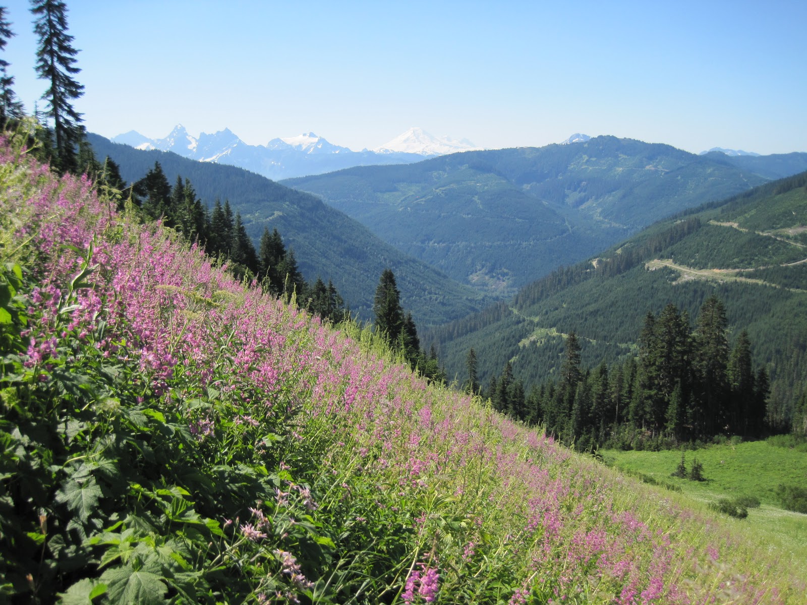
The alpine flowers were in glorious splendour that day. Some we knew well -- Indian paintbrush, mountain lupine, yellow glacier lily, Sitka columbine, alpine heather, spreading phlox, pearly everlasting, cow-parsnip, fireweed and sub-alpine daisies. Others required an identification search in a field guide when I got home -- Martindale's lomatium, pink monkey-flower, Davidson's penstemon, and heart-leafed arnica. Our eyes feasted on the mountainsides dressed in colour--slopes clothed in subtle shades of blue and purple punctuated with brilliant splashes of pink, yellow and red.
 |
| Pink Monkey-Flower |
 |
| Mountain Lupie, Sub-Alpine Daisy, and Heart-Leaved Arnica |
 |
| Hillside of Fireweed |
 |
| Yellow Glacier Lily |
It seemed that we gasped with every turn along the trail; the scenery was beyond description. Certainly our surroundings this day were declaring the Glory of God with a resounding shout. In fact, Ruth saw it as a metaphor for 2 Corinthians 3:18. In every turn, and every new vista, there was increasing glory.
 |
| Snow Cave in Middle of August |
As we crossed through a mossy bowl then up the other other side, we stepped around a corner and saw one of the snow caves we had read about. It was smaller than it would have been a month earlier; still, it was hard to imagine that this remnant represented only a tiny bit of the snow that filled this area just months before.
 |
| Precipitous Back Side of Lady Peak |
The back side of Mt. Cheam looks radically different from the side one views from the Trans-Canada, and as we entered the col between two colossal mountains where the trail forked, we wondered which was the one we were aiming for. We followed a less-troddened trail up a slight slope until we could go not a foot farther without falling to the valley 4,000 feet below where Jones Lake lay like an giant sapphire amidst a sea of green. To the right, we looked up, and up, and up. Surely that was not our destination, but we couldn't be sure. We snapped a few pictures and backed away from the precipice.
 |
| Ruth Crossing a Snowfield |
Sound travels a long way in the thinning atmosphere, and when Ruth caught sight of Jim and Bob starting their ascent of Lady Peak, she called to them to ask which way to go. Bob pointed to the rocky trail on the other side of the col, so we traversed the two snowfields separating us from the track that wound its way upward.
We were surrounded on every side with breath-taking beauty and stopped occasionally to fill our lungs with the incredibly sweet alpine air. There were moments when we felt we were on the set of the classic
Heidi movie. As we moved upwards, the trail narrowed and became rockier. Eventually we came to some scree slopes where at every step we knew one misstep would be the start of a tumble that would not have a pretty ending--and perhaps a deadly one.
 |
| Trail Up Out of the Col -- The Way to Cheam's Summit |
We were not the only ones on the trail, but in the whole day we counted perhaps eleven other happy wanderers--some we caught only a glimpse of on a far-off slope. In an area with a population of four million, it was hard to believe that fewer than a dozen were roaming the same hillsides. We stopped a couple of times to nibble on trail mix and take a draught of the water we carried with us, needing both the instant energy that comes from nuts and dried fruit and the hydration that comes from Adam's ale.
 |
| Nutrition and Hydration Break |
Gradually, though, we worked our way, step by step, towards the peak that beckoned us with its siren call. Our backpacks grew heavier as our legs led us onward, but nearly four hours after we arrived at the parking lot, we were tramping the last few metres towards that summit we had seen so often as we drove down the highway.
 |
| Last Steps Towards the Summit |
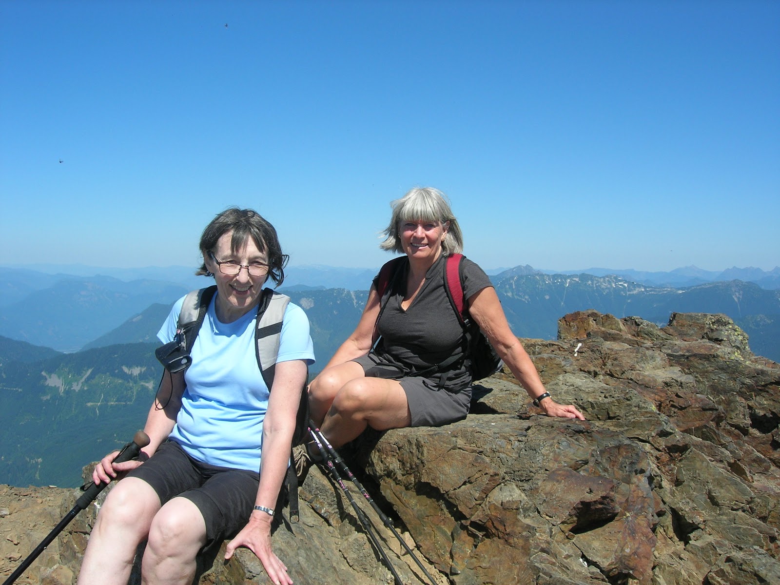
The elevation of Mt. Cheam is 6,929 feet above sea level, and we were at the apex of this mighty mountain. Although that last scramble was in a way terrifying (like, what would happen if a gust of wind came along), neither of us could bear to turn back without taking the iconic picture of us on the top. Fortunately, Jim and Bob had given up their attempt to find a way up Lady Peak and had opted for Cheam instead. They had arrived at the top shortly before us, and Jim offered to take a picture of the two of us taking the last steps of our ascent and then one memorable picture at the top. Neither of us had an appetite for lunch on that stomach-dropping pinnacle, so we made our way down and ate our lunch at a safer spot, but still one with an incredible view.
 |
| Sitting at the Top -- 6,929 Feet Above Sea Level |
 |
| View from Our Lunch Spot |
At last, it was time to begin our descent. After most of the day slogging upward, we wondered how our knees would handle going down. We were pleasantly surprised, though, and we made good headway towards the bottom. It was a hot day, and when we reached one of the larger snowfields, we tossed our backpacks aside and threw ourselves onto the ground for a quick roll in the snow.
 |
| Linda (top) and Ruth (bottom) Make a Snow Angel or Two |
 |
| An Exhilarating Splash Before Hitting the Road |
Six and a half hours after lacing up our hiking boots, we arrived back at the parking lot--my Subaru sitting alone in the deepening shadows. A quick trip to a waterfall to splash icy water on parched faces, and we were on our way, resting in the thrill of meeting a goal we had set a year earlier.